This web page describes the seventh leg of the third 1997 sailing trip with S/Y Thetis in the Aegean and Eastern Mediterranean. It covers the solo sail from the anchorage of Kouremenos in East Crete to Souda in NW Crete. The sail was interrupted by a few land excursion to points of interest. I visited Sitia, the Toplou Monastery, the Hohlakies Gorge, the Minoan site of Zakros, the Zakros Gorge, the ex leper colony in the Spinalonga Island, the harbors of: Iraklio, Rethymno, Hania, the famous Samaria Gorge, Agia Roumeli, and Hora Sphakion. The web page is illustrated with photographs, also included are historical and geographical descriptions of the places visited as well as several links to other related web sites. For more details on Crete see the World Cruising Wiki.
- Zoom-Out
- Kouremenos
- Sitia
- Spinalonga Island
- Iraklio
- Rethymno
- Souda
- Hania
- Samaria Gorge
- Agia Roumeli
- Hora Sphakion
- Toplou Monastery
- Kato Zakros
- Hohlakies Gorge
Monday September 22, 1997 Day 46
I slept surprisingly late (until 7:45) considering that I went to bed at 9:30; I must have been really tired. I did nothing until 10:00 when I started considering whether to go to Sitia or not. The wind here was somewhat down and the sea looked calm, but the weather forecast called for a gale and the wind did howl all night. I decided not to move but to stay where I was and see how things develop, as I did not relish another wet beat against the wind and waves. Also it was too cold to sit in the cockpit despite the sunshine.
Now that the plug polarity problem had been solved, the DC to AC adapter was usable again, and I was able to operate the PowerBook computer and update a number of data files. This killed some time and allowed the day to get warmer.
 After lunch I went snorkeling and checked the anchors. I did not like what I saw. The secondary Brittany anchor was too close to a very large rock extending to almost 1 m below the surface. This could make its retrieval dangerous risking a grounding. The primary CQR anchor was wedged under another rock and it could be fouled and difficult to retrieve. The good news was that as long as the wind came from the North away from the shore Thetis would be secure. Departing, however, would be fun.
I then worked some more with the computer. I like this combination of being afloat and yet being able to use a computer! In Karpathos I had discovered that the butane canister with which I recharge the soldering iron was empty, but I did find a replacement canister in town. I now recharged the soldering iron and soldered the leads of the spare auto pilot to its new plug so that the connection would not corrode too easily. Then I attacked the wind generator problem. Following Air Marine’s advice, I went over every contact from the generator post to the generator switch at the panel and soldered them to reduce their resistance. The factory was right. The problem was definitely a bad connection. The electricians in Athens do not really comprehend 12 volt marine systems and do not appreciate that contacts made with connectors good for household 220 V systems may originally work but after some corrosion by exposure to the salty air their resistance becomes critical at the low 12 V and the current flow is seriously impeded. As far as the wind generator was concerned what happened was this: the generator has an internal regulator which adjusts the alternator field current according to the battery voltage. With a highly resistive contact, the regulator senses a much higher voltage than the actual voltage across the battery and assumes that the battery is charged when in fact it is not. It then cuts off the field current and the generator spins freely, producing noise without generating any electricity. After reducing contact resistance, the generator worked and once again started re-charging the batteries.
By late afternoon the wind was howling again and it was very cold outside. I boiled some pasta and ate it with the left over sauce from last night.
The Navtex report was strange. A new gale was blowing over the Central Aegean but the forecast for the East Cretan Sea (where we were) called for only 5-6 on the Beaufort Scale from the NW. Based on this information I decided to make a dash tomorrow morning for the safer harbor of Sitia.
Tuesday September 23, 1997 Day 47
 I got up at 6:15 and listened to the AM radio marine forecast broadcasted from Rhodes, thus preserving Navtex paper, which was running low. The forecast was essentially the same as last night’s so the plan stayed the same: we will be departing for Sitia.
I was afraid of hitting the large rock near my secondary anchor, so I started pulling both at the same time so that the primary on my right will keep me away from the rock. The trick worked and the Brittany anchor came loose while the primary, which was wedged under the small rock, was still holding. I raised some more chain until I was almost over (apeak) the primary CQR and left it while I was stowing the secondary anchor, hoping that the primary might dislodge. As I did not want to move the boat forward into the shallows, I then backed up very gently, moving to the left. This did the trick; the CQR was dislodged and I was able to easily bring it up. I am not sure whether it was my “brilliant” tactics or just the brute force of the powerful windlass that saved the situation. I strongly suspect it was the later.
We were on our way to Sitia by 9:15. I set a NE course to a waypoint 8 M away that would leave Cape Sidero on the West of the boat with a comfortable margin. It was a fairly easy sail with just a reduced genoa, moving at a speed of 5 to 6 knots, without getting wet in the NNW wind of 20 - 25 knots. At the waypoint I rolled-in the genoa and motored W for 5 M, avoiding the dangerous Spitfire Reefs north of the cape. Then we turned straight for the Sitia harbor 13 M away, sailing again with a reduced genoa. Our speed was a nice 7-7.5 knots!
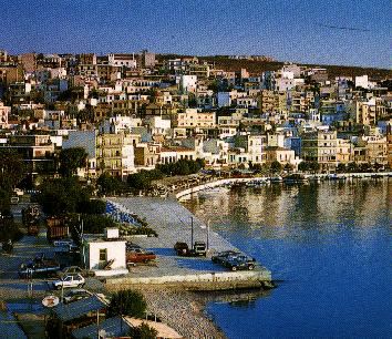
We entered the Sitia (Σητεία) harbor [35° 12.5' N 26° 06.5' E] at 13:30. We had come 24.9 M from Kouremenos. It was perfectly calm inside the harbor. One would never had guessed that there was a force 7 wind just outside the harbor. I docked sideways without any difficulty since another young German sailor from a sailboat already docked came to catch my lines.
I went ashore and called my mother to let her know that I was fine, and since I was very hungry I made an omelet which I ate with fresh bread that I bought in town. The town is sizable and most attractive, it has an archaeological museum, a Venetian castle, an ethnological museum, and at least one movie house. There are many pleasant stores and restaurants and the people are friendly. The fly in the ointment was that there was an on-going dusty construction at the jetty, and while I was resting after lunch I heard a lot of noise with its source very close to Thetis. They were pouring cement onto concrete molds which were right next to the two sailboats alongside the jetty. Thetis’ deck was covered by splashes of wet concrete. I spent over an hour with buckets and brushes cleaning the splashes before they hardened.
By evening time there was plenty of hot water in the shower bag and I had a long luxurious shower. I then went ashore and, after calling Alice, I strolled along the promenade choosing a restaurant to go and eat. I also located a store that sold camping gaz and I replaced the canister which had emptied few weeks ago in Turkey, thus avoiding the danger of running out and not being able to cook, or worse, not having my coffee first thing in the morning.
I sat down to dinner in one of the restaurants at the esplanade. While waiting for the food to arrive, a bearded elderly gentleman who was also eating by himself in a nearby table engaged me in conversation in accented Greek. He was a painter from Denmark and had been living in Sitia for six years. He thought Sitia is the most pleasant town in Crete because it has not yet been overrun by the hordes of tourists. He was very interested to hear that I am with a sailboat because he too is a sailor. He would have loved to show me around and even come sailing, but he was flying to Athens in the morning for his yearly trip to Denmark where he exhibits and sells his paintings. Too bad, because he seemed a most interesting character, and his Greek was very good.
After quite a good dinner I did a naughty thing. I went to the movie theater which was playing 12 Monkeys. The show started late and it was not over until 01:20. It was good that I had seen the film before because I was so tired that I am afraid I slept through parts of it.
All together a full day!
Wednesday September 24, 1997 Day 48
I broke down and rented a motor scooter for 2 days. First thing, I went to the archaeological museum that was right next to the scooter place. It does not have too many things but there are some nice Minoan vases and an interesting figurine made of rhinoceros horn and clay.
Next to Thetis was a small chartered sailboat, in not-so-great condition, with four men aboard: two Germans - father and son (who had helped me dock yesterday) and another father and son pair from Spain. The were very attractive people. They had chartered the boat from Kos but as they were approaching Crete a strong gust tore to shreds their old main sail. Now they were marooned in Sitia waiting for the arrival of a replacement sail. When they saw me driving up to Thetis with the motor scooter, they became very interested. They decided that this was a very good idea and they too were going to rent scooters and make the best of a bad situation.
I then rode toward Vai (Βάϊ). Vai is located very near Cape Sidero, and in the area that I was looking for an anchorage but was too rough to stay. Vai is a beach with a large forest of palm trees which is said to be unique in Europe (one could argue, of course, that Crete is not Europe).
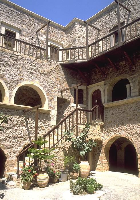
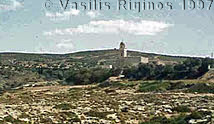
On the way to Vai I visited the Toplou Monastery. They have an exemplary exhibit of Cretan icons, many from the Theotokopoulos (El Greco) school, early engravings, and many monastery papers and ecclesiastical books. One could not ask for a more well-lighted and labeled display. The monastery has been active through most of the Cretan modern history, from early Turkish occupation to the German occupation during World War II, a center of Cretan resistance. The Germans actually confiscated all of the monastic property in retaliation and closed down the monastery.
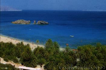
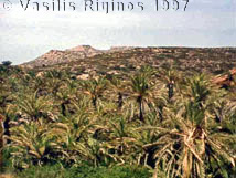
Vai was disappointing as it is very developed and overrun by tourists. Physically it is a beautiful beach and the palm trees look nice, but it is surrounded by a very large concrete parking lot full of cars and buses. The actual beach is covered with long chairs and umbrellas, packed with sunbathing people. There is a path up the hill which leads to a large overlooking restaurant. I took a quick swim and left.
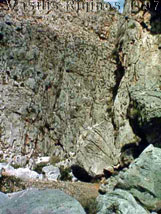
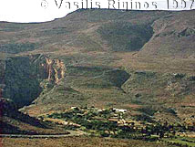
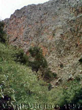
Driving back towards Zakros just after passing Kouremenos I saw a sign “To Hohlakies Gorge 2 km.” I followed the sign which led to a small dirt road past a village into an olive grove. Then the road ended abruptly. I followed a path on foot, and after several false turns I got to Hohlakies (Χοχλακιές). The gorge is a few kilometers long, very pretty. The path within the gorge was surprisingly well marked. After about an hour more walk it led me to the Karoumbes cove (Όρμος Καρούμπες). It it is a lovely little cove, with crystal clear water, and best of all there was no other soul in sight. Although I was missing Alice and Corinna, I was luxuriating in my solitude, which in our frantic age has become one of the most precious and rare luxuries. I had a much better swim at Karoumbes and then walked back up the gorge to the scooter in the olive grove. All together this was a 3 hour hike and a ½ hour swim.
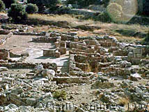
I drove on to Zakros. On the way, guess who I met? The two Germans from the sailboat docked next to Thetis. They did rent two scooters, but alas one of them broke down, so now two of them were with the scooter while the Spanish two of the crew had gone to a village to call the rental agency for help. As there was nothing that I could do for them, I regrettably left them. They did have bad luck. There is another gorge there but I left that one for the next day. I continued to the Minoan site at Kato Zakros. I walked through the ruins until the closing time. Then I drove back to Sitia. By that time the sun was low over the horizon and it was a very cold ride in contrast with the great heat during the day.
After I got back to Sitia, I went shopping. Among other things I went to a butcher shop and bought a nice cut of beef with which I made a pot roast with a garlicky lemon sauce. This was the first time that a meat dish was prepared onboard Thetis. I ate it with rice. It was delicious and best of all and there was a good amount of leftover for other meals. After eating I walked to pastry store on the promenade and had some loukoumades.
Thursday September 25, 1997 Day 49
I started the day with Diesel sports. First I changed the Racor fuel pre-filter which was rather dirty. I then primed the filter, bled the fuel lines, and tested the motor. I then transferred fuel from both of the jerry cans into the tank and drove each can separately with the scooter to a gas station and refilled it. By this time it started to rain. I donned the storm jacket and rode the scooter to the post office and mailed several postcards. I then tried to visit the ethnology museum but it was closed, no reason given. I also called Telemachos, our caretaker in Samos, in Athens. His wife, Maritsa, has recovered from her operation and they are to go back home but they are waiting for improved weather before they get on the boat for Samos.
The boat with the two father and son pairs had received its new sail and was ready to sail back to Kos. I tried to talked them into waiting another day because of the still very strong winds but they wanted to leave.
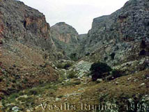
By this time the rain had stopped and I rode to Ano Zakros (upper Zakros) where the path that leads to the Zakros Gorge begins. I walked the 6.5 km through the gorge to Kato Zakros (lower Zakros) where I had visited the Minoan site yesterday. The gorge is nice but not as isolated as the Hohlakies Gorge. Up on the road, at the beginning of the path, the sign indicated that there are several caves with Minoan burials within the gorge. Hard as I tried–I checked every cave I saw–I was not able to locate anything Minoan or archaeological. I only found evidence of the presence of goats. Nevertheless the walk was very pleasant. Near the end of the gorge there are many laurel trees which give a very pleasant smell.
In Kato Zakros I had a swim to cool off as the day, by then, was quite hot. I also ate my picnic lunch and then hiked back up the gorge to the parking lot where I had left the scooter. I drove back to Sitia.
I walked up to the Venetian Castle but it was closed due to renovations! I purchased some supplies and returned the scooter. I had a very pleasant dinner at Michos: mizithropites (Cretan cheese pies) and kontosouvli (pork grilled on the spit) together with a very good house wine. This restaurant is very old fashioned and does not seem to have been affected at all by the tourist boom.
I went to bed totally exhausted.
Friday September 26, 1997 Day 50
The weather report was not very encouraging: more wind. The East Cretan Sea, however, was expected to have only 5-6 on the Beaufort Scale and I was only going as far as Spinalonga, 22 M away. I left Sitia at 7:00 and was at Spinalonga by 10:30. The wind on the way was not that strong but only 15-20 Knots from the West, right on our nose, which gave me no option but to motor.
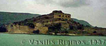
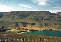
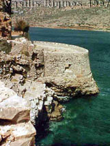
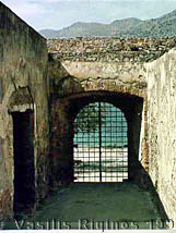
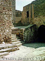
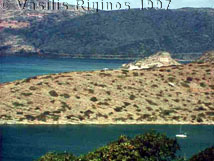
The Spinaloga Lagoon [35° 16.8' N 25° 44.4' E] is formed by a long peninsula, almost an island, connected with Crete with a very narrow sandbar, near the very developed region of Elounda. At the western tip of the peninsula there is a small island, the Spinalonga Island (Σπιναλόγκα). On the Cretan side of the lagoon are high mountains. As described by Heikell, the Spinalonga lagoon is very calm but experiences fierce gusts from the mountains, although it is somewhat sheltered on the lee side of the Spinalonga Island. The island is surrounded by most imposing Venetian fortifications. I anchored as close to the island [35° 17.7' N 25° 44.3' E] as the depth allowed, the lagoon being very shallow with hardly any depths deeper than 5 m. I launched the zodiac, which had been lashed on the deck since Karpathos, and after waiting for about half an hour to make sure that the anchor had settled and was holding, I went ashore on the island.
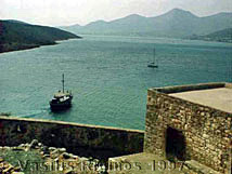
The island was used as Greece’s main leper colony as late as 1957. It is now a very popular tourist attraction, the tourists being brought by an endless string of day-trip boats with their loud speakers blaring the spiel in all languages, but predominately in German. They come and go disgorging the tourists at a small landing and taking them back. This seems to go on relentlessly all day until the late afternoon. Surprising enough, the island is not crowded, and walking on it, one gets a very strong sense of isolation. It is very definitely a haunted place. There are on-going efforts to restore the old buildings and fortifications. There are extensive and large Venetian fortifications almost enclosing the island, Venetian houses, a Venetian castle at the island’s peak, and many small Venetian and more recent Ottoman houses. In addition, there are a few large 1930 fascist-style institutional buildings, which were mostly used as hospitals. The lepers, who at any given time did not exceed 200 to 300 people, lived mostly in the old houses, and there are over 1,500 buried here. They lived all by themselves with minimum contact with the outside world until the 30s when the state built “modern” hospital buildings and other facilities for them. These are the most run-down and ugly structures in the island. Other than these, the place has an amazing beauty and attraction as the lagoon is really very beautiful and so are the little houses and churches. But one cannot help but feel the weight of all the miserable souls that perished here after years of neglect and isolation.
|
|
I stayed in the boat, swam, had lunch, and watched the tourist boats come and go. The gusts were coming more frequently and with greater ferocity. As the Navtex afternoon forecast was giving gale warnings for the next 24 hours with 5-6 on the Beaufort Scale in East Cretan Sea and force 7-8 with thunderstorms for the West Cretan and Central Aegean it was clear that I would not be sailing tomorrow. Since I did not want to spend another day among the day trip boats and their loudspeakers, I decided to move 0.7 M East to a cove on the Spinalonga peninsula within the lagoon.
I raised the anchor and motored very slowly while keeping one eye on the depth reading. I anchored in the cove [35° 16.8' N 25° 44.4' E], which appeared well protected with the gusts less violent than the lee of the island. By 18:30 the sky was completely overcast and it drizzled, but the water was dead calm despite the gusts. I could see across the lagoon the lights from the tourist Mecca, Elounda, but here in the cove it was very quiet and peaceful. There were two other boats: a British sail boat and a French Catamaran with no people visible.
By nightfall it started to rain in earnest. As I still had pot roast with lemon sauce leftovers, I warmed it and had it with a pilaf.
Saturday September 27, 1997 Day 51
It rained all night and there were fierce gusts from the mountains.
The British flagged-sailboat Fistlin Lente was having some anchor problems. The man was diving with the snorkel, pulling at their chain while a young woman was maneuvering the boat. I went over with the zodiac to help them. Their anchor chain was fouled on a very large loose fisherman anchor on the grassy sandy bottom. With three people it did not take too long to disentangle the chain, despite the gusts. The couple was Italian, Paula and Valerio. Valerio, a retired history professor, owns the boat but keeps her under the original British flag for tax reasons. Paula, much younger than Valerio, is a physiotherapist on a sabbatical. They had sailed from Elba and are on their way to the Agios Nicolaos marina where they will leave the boat for the winter. They plan to resume their cruising in the early spring and go north on the Aegean and down the Turkish coast. They are a very personable couple with great interest in Greece and archaeology. We agreed to get together in the evening for drinks and dinner.
Later I took a 1½ hour hike on the peninsula. The view was very nice and I flushed out a great number of quail. I returned to the boat just as the wind increased to 38 knots with higher gusts. By the afternoon the gusts were so strong that the zodiac, together with its outboard, was totally raised above the water. I had to raise it and lash it securely on the deck. The anchor was holding but Thetis and the other boats were gyrating all over the cove.
There was no way to launch any inflatable for cross-boat visits and the dinner plans had to be scrapped. I made pasta with fresh tomato, pepper, onion, and wine sauce. I made enough sauce to have for another meal. Later in the night the wind had settled to 18 knots and the Navtex forecast called for gradual improvement with winds of 5-6 on the Beaufort Scale in the West Cretan. Maybe I could make a run for Rethymno tomorrow.
Sunday September 28, 1997 Day 52
 I got up early and heard the 6:20 weather forecast on the radio, but there was no new information other than what I had received last night from the Navtex. I left the cove at 6:50 motoring for 4 M to clear the notorious Agios Ioannis Cape. Then I raised the main sail, still on the 2nd reef, and unrolled half of the genoa. As the wind was from the WNW, I was barely able to sail very closed-hauled, making 4.5 to 6 knots depending on the gusts.
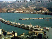
A few hours later it was clear that with this head wind the chances of getting to Rethymno before dark were very slim. As I was very reluctant to enter a new harbor after dark while singlehandling, I decided to either go to the island Dias or to Iraklio (Ηράκλειο). With some trepidation, because of the discouraging information from Heikell, I chose the latter and set a course for Iraklio.
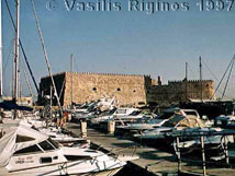
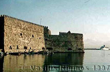
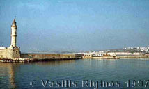
Just a couple of miles off the harbor, the wind diminished to the point that sailing was impossible with a speed over 1.8 knots, so I motored the rest the way. I entered the Iraklio harbor [35° 21' N 25° 09.2' E] at 14:55 and after 41.5 M. It is a huge commercial harbor with a tiny inner Venetian harbor within the commercial one. As both the pilots recommend the Venetian harbor, I entered it. Since their publication it has been converted to a very nice marina with floating piers and laid moorings. It was very, very crowded. There were, of course, no marina attendants or anyone to recommend where to tie, this being Greece. Luckily I saw a man washing a cruiser, and as I maneuvered in the very tight space I called to him, in Greek, asking if he knew where one could tie a boat. First he said that there were no spaces, as all were occupied by the members of the yachting club. Then, after I told him that I just wanted to stay for only one night, he directed me to a spot belonging to another boat that would be returning on Tuesday. After I practically swore to him that I would be gone by then, he helped me with the lines. Alas, before I could thank him he was in his cruiser and leaving the harbor. It was true that almost all the boats, and there were a fair number, mostly cruisers, were local. There was only one foreign sailing yacht and it was outside the old harbor rafting in the commercial harbor and in a spot exposed to the swell. Being a native does have some advantages, sometimes.
The town of Iraklio is now nothing like the most agreeable town I remember where Alice and I had stayed 30 years ago. Heikell is absolutely right in quoting Adam Hopkins: “On the first day, one knows beyond contradiction that Iraklion is one of the least pleasant cities of the Mediterranean …” It is indeed ghastly. It seems that almost every other store is either a travel or a car rental agency. Most restaurants are of the fast food variety. It has heavy traffic and a lot of noise and dust. I walked to the St. Minas Cathedral, where a wedding was being held. That somehow softened the otherwise negative impression.
As I did not feel like eating in any of the nearby restaurants teaming with noisy tourists and preciously few Greeks, I warmed the last of the pot roast and ate it. Then I walked to the only old-fashioned store I had seen during my walk which advertised “Λουκουμάδες από τό 1926” (Loukoumades, honey donuts, since 1926) and had a small portion. These were like the ones I remembered from Iraklio, very fresh and covered with honey and sesame seeds.
If the weather is anywhere near manageable I will leave tomorrow after visiting the museum.
Monday September 29, 1997 Day 53
I decided to visit the museum and do some light shopping before leaving the harbor. I followed the street map and after some walk found the museum but it was closed, today being Monday. After walking through the town and its travel agencies for over ¾ of an hour, I found one grocery store (yesterday I had seen none) and one bakery. This town is not only full of traffic and noise and dirt but it appears to have very few of the basic necessities, excluding tickets to almost anywhere else.
By 9:00 Thetis and I were pulling out of the harbor. The sea was glassy. I had not seen such a calm since Kekova. We motored to Cape Stavros after which I raised the main, shaking out the reefs, to catch the scant wind. We motor-sailed all the way to Rethymno which we reached by 15:20, covering all together 39.8 M.
 The Rethymno (Ρέθυμνο) harbor [35° 22.3' N 24° 29.1' E] was undergoing extensive enlargement and there was heavy construction. This was the root of all our troubles. According to both Greek Waters Pilot and the Greek Portolanos, the preferred location for small boats is the East side of the harbor, which provides total protection, while the West jetty is very much exposed to the Northerly winds. I proceeded to the East jetty where there already was a sailboat but the jetty was mostly occupied by the construction equipment. and I managed to squeeze stern-to behind a filthy cement freighter ship and a dirty fishing boat. Just after I jumped on the jetty to tie my lines I was told by the cement ship captain that another cement ship was coming and I could not stay there. Since might makes right and the place was incredibly dirty and smelly, I pulled out. The only choice was to come sideways, which is not my favorite docking, between a large crane and a tug boat. But again I was told by the tug captain that he would be bringing another crane there shortly. This left as the only alternative the West jetty, again sideways, and a totally exposed position to the NE. I pulled behind another sailboat and one of its crew did come to help. He had trouble catching the line I threw and he did not know how to tie a proper knot. Afterwards I did re-tie the lines and also tied two spring lines and placed extra fenders, and since there was hardly any wind it was safe for the time being, although there was an amazing amount of swell considering how calm the sea was outside the harbor. The swell was pushing Thetis against the concrete. Also, there was a never-ending procession of cement trucks going to the end of the jetty where there was more construction going on to extend it.
The sailboat in front of Thetis seemed to be populated, in addition to the fellow who caught my lines, by at least seven other men and two women, all in their bathing suits, popping in and out of the cabin and drinking beers. I tried to ask them about the swell and the overnight safety but there was no common language. They gave me to understand that they were all from Poland. As I was not at all sure about the safety of the boat and especially concerned about large ships, I called the Limenarchio (Greek coast guard) on the VHF. They have no idea or care concerning safety but they informed me that both sailboats were in the way of two large cruise ships due to arrive during the night.
Later the other sailboat which was docked between the cranes on the East side of the harbor moved right behind Thetis. It was a chartered boat with 4 German men. They too were told to move by the crane operators. An officer from the Limenarchio (Coast Guard) came to tell us all that we must move to make room for the tourist boats. He then had the nerve to ask us to go to the Limenarchio and pay the harbor dues. I translated his instructions to the Germans but no one could communicate with the Poles.
After taking a hot shower, I walked to the Limenarchio and talked to the on-duty officer, who was very polite and friendly. I explained to him that where they were suggesting for us to move had two problems:
- There was no space because it was occupied by the monstrous lines of a ferryboat, and
- There were no cleats or bollards to tie down a small sailboat securely. The existing ones were too far apart, adequate only for a large ship.
Just as we were discussing this, the Germans and the Poles came in. The officer suggested that if we did not want to go to the proposed spot we could anchor ashore, after 9:00 PM, on the East side of the harbor, which is very safe, but we would have to move before 8:00 AM when the construction work resumes. I immediately agreed to this but the Germans totally refused and the Poles did not follow anything. I asked him about the Hania harbor. He said he was afraid that it may be very crowded and hard to find a good berth and recommended the Souda harbor. Souda Bay houses one of the major bases of the Greek navy and I read that it was closed to yachts. He told me yes, it was, but this restriction applied to foreign yachts and not to Greek yachts. Just to make sure, he called the Limenarchio at Souda and confirmed it. All I would need to do would be to hail the Souda Limenarchio before entering the bay. As Souda Bay is considered the most secure anchorage in western Crete, I decided to go there. I paid the outrageous harbor fees, the highest I had ever paid, for maybe one of the most problematic harbors I had ever been in and bid the officer good night. He told me that I did not have to move the boat before 11:00 PM. He then pleaded with me to help him out with the balky Germans. I tried but there were obstinate. As there was nothing more that I could do for him I left to go for supper.
The old town of Rethymno is charming but full of tourists. I walked around and looked for a food store as I needed a few supplies, especially fruits. Being Monday evening, however, all food stores were closed. I sat at a restaurant. The menu was in German and English. No Greek. I asked the proprietor if he spoke any Greek. He did of course, and he very apologetically explained that there are hardly any Greek customers. The food was indifferent.
Back on board, I cast off the lines and moved to the middle of the East harbor where I anchored at 7 m depth. After I turned on the anchoring light I relaxed. What a run-around! Thank goodness there was no wind. Imagine all of this in bad weather! I also noticed that both the Germans and Poles had moved their boats where the Limenarchio wanted them to. Bad place!
Tuesday September 30, 1997 Day 54
The night was uneventful other than the arrival of the two cruise ships and their prop wash. Was I glad not to be alongside the cement jetty with long lines holding the boat not very well, near those propellers!
 I raised my anchor at 7:30 and left for Souda (Σούδα). The water was dead calm and there was absolutely no wind. Later there was a very slight breeze from the NE and I was able to sail with both sails trimmed very close. As I came near the bay I hailed, as instructed, the Limenarchio on VHF channel 9. They asked for the name of the boat, the registration number, the name and nationality of the captain, and the names, nationalities, and passport numbers of the crew and passangers. After I gave them all the information they instructed me to wait for 5 minutes and then hail Souda Control on channel 16, follow their instructions, and to hail the Limenarchio again on channel 9 when I was at the entrance of the harbor.
I waited for 5 minutes and called Souda Control, which is operated by the Greek Navy. They were expecting my call and asked again for my name and my Greek id number (αριθμός ταυτότητας). They then said that I was cleared to enter the bay, to monitor channel 16 for instructions, and to contact them again when I was 1 M from the harbor. I noticed then that I was being followed by the British Navy mini carrier Fort George. She was not very far behind me, and as I was getting very nervous about them they hailed me on channel 16: “Greek sailboat Thetis, this is Her Majesty’s Ship Fort George, we have you well in sight and there is nothing to worry about. Please maintain your course as we overtake you.” I must say I gave a sigh of relief as she was a colossus overtaking tiny Thetis.
A school of at least 5 dolphins surfaced near us but did not stay; maybe they too were scared by the carrier. On channel 16, meanwhile, there was traffic from the US Navy vessel Concord, which was asking permission to execute “a diving operation” to repair their propeller. The conversation was very funny because the American operator had a very strong southern drawl and the Greek operator had a hard time understanding him. Typical exhange:
Greek: Please ask your skipper to contact us personally when he is available.
American: Roger, copy that.
Greek: No, do not write it down just tell the skipper and not Roger.
In addition to the British carrier and the Concord, there were a large number of Greek destroyers and many small Greek Navy boats. In the commercial harbor there was US “Mail Ship,” a Turkish freighter unloading, two cruise ships, several smaller fishing ships, and several day-trip boats.
I hailed the Souda Control who told me to proceed to the commercial harbor and to have a good stay. I then called the Limenarchio. They directed me to come sideways at a jetty with two day-trip boats and to a spot well clear of the others [35° 29.5' N 24° 04.5' E]. There was no one to help me and the jetty was higher than Thetis’ deck. I managed with some difficulty to jump in and out since I had to be ashore to reach the bollards but could only reach the cleats on the concrete from the boat. The only thing that helped was a slight breeze pushing Thetis toward the pier. The time was 11:45 and the distance covered was 22.2 M.
The people at the Limenarchio, where I was instructed to report after docking, were very friendly. There was a campaign going on to register all EPIRBs (Emergency Position Identification and Rescue Beacon). Amazingly enough, it seems people buy them at a high price and then fail to register them, which defeats the whole purpose. They were absolutely amazed that my EPIRB was already registered in the US. They were very eager to talk as they had never met a Greek singlehandler before. They ordered coffee and would not let me go. Also they were interested about Turkey and specifically about Turkish harbors and officials. They were full of envy when they heard that their counterparts in Turkey are not the ones to collect the harbor fees. They explained that collecting these fees are among the most odious of their duties. I had a very hard time extricating myself from them.
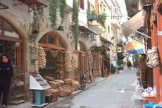
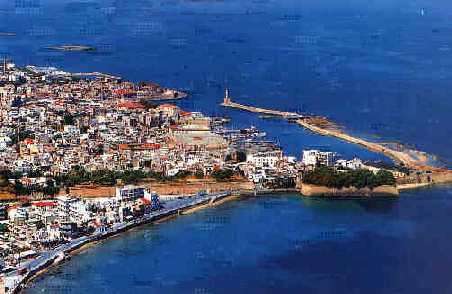
I called my brother Byron and asked him if he could find and send me thermal paper for the Navtex as I was running out. After a snack onboard I took the bus from Souda to Hania 7 km away. Hania is a delightful town. The old city is very picturesque and has the inevitable souvenir stores, rooms for rent, restaurants, and jewelry stores. A whole street is devoted to leather goods. The marketplace (food) is amazing; it is crowded with small and a large stores selling anything from meat, wines, dried fruits, to herbs, chocolates, fruits, breads, pastries, fish, flowers, etc. I also went to the archaeological museum. It is housed in a large Venetian building and it is very well appointed. It has exhibits from the Minoan to the Hellenistic times, all well-lit and labeled. Some very nice floor mosaics. The harbor consists of two sections: the West which is exposed to the North and is surrounded by a promenade with restaurants and cafes and no boats are allowed to dock, the East which is narrow and has floating piers to accommodate large number of boats. It was crowded and had I come here with Thetis it is doubtful if I could have found a berth.
I rented a motor scooter for 3,500 GRD/day. I rode that back to Souda. Tomorrow I plan to go to the Samaria Gorge which is considered one Crete’s main attractions. I had a very pleasant hot shower (plenty of hot water thanks to the watermaker) and had an ouzo while watching several people fishing from the pier. I walked around a little. Souda is nothing special but feels homely and comfortable. I found a chandler and bought several spare navigation bulbs and a new rear white light navigational fixture. I inquired at a travel agency about how one goes about visiting Samaria. They told me that other than joining a tour one has to take the bus at 6:00 AM from Hania to Omalos. Then after walking down the gorge you take the boat from Agia Roumeli to Hora Sphakion and then the bus back to Hania.
I then bought a gyros from a store labeled: “Ovelisterion” (Οβεληστείριον) which means a store that specializes in meat grilled on the spit. There are Ovelisteria everywhere in Crete. I took the gyros aboard and ate it with pasta and leftover tomato sauce. The refrigerator was now on all the time set at +10°C and was working fine with manageable consumption of electricity, which gets replenished by and large by the now-working wind generator. The fishermen engaged me in conversation. They were amazed that I was alone and a Greek. I had to excuse myself that I too wanted be social but I was going to bed early as I was visiting Samaria in the morning. After politely hearing their tales of visiting Samaria at least 20 years ago and how they were so stiff that they could hardly walk for a month, I retired to the cabin. I set the alarm for 5:00 AM and went to bed.
Wednesday October 1, 1997 Day 55
I was woken by the alarm. After a hasty coffee I stuffed a canvas bag with a towel, a bathing suit, a book, and a bottle of water in a thermos jacket. I put on a pullover, my hiking boots, and the storm jacket, took my walking stick and camera and left. I rode the scooter in the dark cold morning to Hania. After several inquiries I found the bus terminal and got there just 5 minutes before 6:00 AM.
Unfortunately the information from the travel agency, while correct until last week, was now obsolete since as of Monday the first bus for Omalos does not leave now until 7:30. I bought a round trip ticket Hania - Omalos - Sphakia - Hania) and sat on the bench reading a book. There were a number of people waiting and busses were called 5 minutes before their scheduled departure. As there was heavy smoking in the waiting room and it was too cold and dark to read outside, I went for a walk. During the walk I saw a bakery and I bought a bag of Cretan cookies made with sesame and olive oil (κουλουράκια). It was a very good thing because I had no other food with me, which was a big mistake.
Finally it was time to board the bus. It was packed. As I was there early I had a window seat. I was the only Greek other than the driver. There was already faint daylight as the bus rolled out of Hania. After a few kilometers on the highway, it turned to a smaller road and started climbing up and up on the mountains on a road with many winding turns. The vegetation changed from orange groves to olive trees, to pines, to cypresses, to mountain pines (έλατα), and finally to bare rocks. After reaching the peak we drove down to the mountain plane of Omalos, crossing the famous road of Mousouron (Η Στράτα των Μουσούρων) immortalized by the national Cretan song. We skirted the village of Omalos and drove straight to Xyloscala (which means wooden staircase) from where one begins the descent to the gorge.
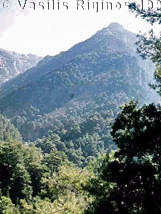
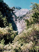
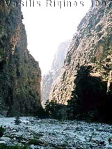
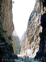
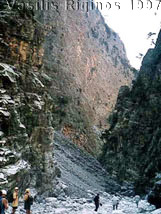
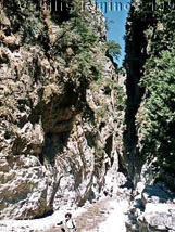
The way down to the gorge is very, very steep and slippery. Having good shoes was very useful. It is very green with pine and cedar trees. The path starts at an altitude of 1,235 m and descends with switch backs, with a crude wooden rail at the most slippery spots, down to 600 m in less than 3 km. At that point the going becomes easier and the scenery is magnificent with the high peaks towering over the gorge. There is water flowing in the gorge, even now in October, not a lot but it is crystal clear. There are many fountains of icy cold pure water along the path. There were also plenty of tourists, way too many for my taste. The path is rough but less difficult to walk on than the one in the Hohlakies gorge.
Altogether the distance from Xyloscala to Agia Roumeli at the Libyan Sea is 17 rough kilometers. I was glad that the hiking boots were well broken-in by now. I wished that I had a small knapsack as carrying the boat bag was definitely not comfortable. I was also glad that I had purchased the koulourakia because I got very hungry. Having the water was fine but since there were so many springs it was less important. Also a good part of the way was totally shaded. It was only in the last few kilometers that the path was exposed to the sun.
|
|
|
|
|
|
|

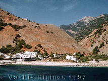
I had started the decent at 8:45 and walked out of the gorge at Agia Roumeli a little after 2:30, altogether slightly less than 6 hours of hard, but not hot, walking. Coming out of the gorge, I was greeted by a fierce SW wind. The waves at Agia Roumeli were large and breaking. The sea was not inviting for a swim. I was by that time, despite the koulourakia, absolutely famished.
After getting a ticket for the Sphakia ferryboat leaving at 4:45, I called Byron in Athens. He did send me the Navtex paper and he gave the name of the courier. It should be in Hania tomorrow. I then found a shady restaurant sheltered from the infernal wind. Since boarding the bus at Hania, I had not heard a single word in Greek. I was not destined to hear one in the restaurant either. The waiters were Russians who addressed me in broken English. The food did taste very good, and the beer was nice and cold.
|
|
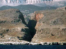
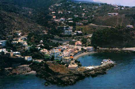
The ferryboat ride was fun. The boat was packed with people of all nationalities, including a family of Greeks. It stopped briefly in Loutro and continued to Hora Sphakion. The setting was gorgeous with stark cliffs and many gorges. What a place! The actual town of Sphakia did not live up to my expectations as most of the houses were of the concrete box variety with iron protrusions from the unfinished roof, but it is steeped in Cretan history. I only had to wait along with many other equally exhausted people for ¾ of an hour for the bus, which left at 5:30.
The ride to Hania was through the dramatic region of Hora Sphakion, up the mountains, down again, through the orange groves. I did not get back to Thetis until past 8:00. I was greeted by an ugly sight. In Sitia the peril of the sea was cement but here at Souda it was wheat germ! The whole deck and cockpit were covered by a layer of wheat germ several cm thick. It must have blown over from the unloading of a Russian freighter one dock upwind. Fortunately I had left most of the hatches closed. But not all. My cabin’s hatch was open and my bed was covered. I cleaned as much as I could with the little vacuum cleaner, had a quick snack, and went to sleep.