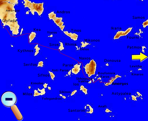
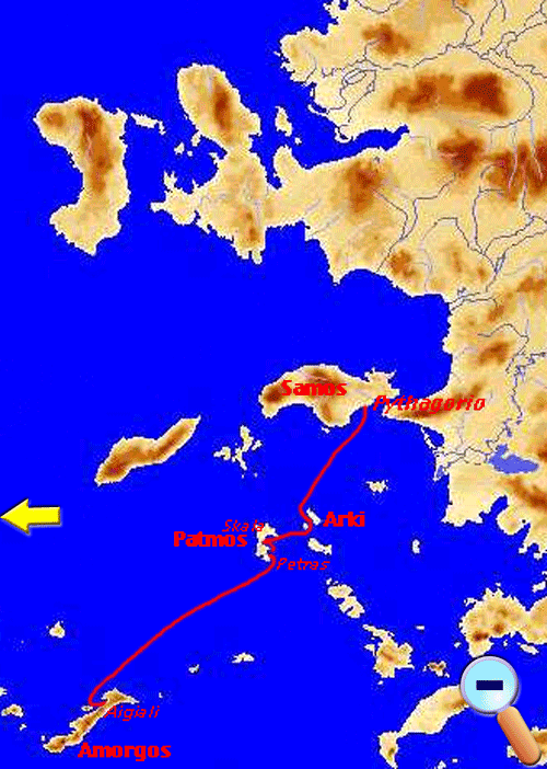
This web page contains the logs of a ten-day sailing trip that my wife Alice and I took with S/Y Thetis in the Greek Aegean from Glyfada near Athens to the island of Samos via the Cyclades (Kea, Syros, Paros, Schinousa, Anti Karos, Amorgos), and the Dodecanese (Patmos, Arki). The logs are illustrated with maps and photographs, and also include some historical and geographical descriptions of the places visited as well as several links to other related web sites.
Friday June 11, 1999 Day 1
Finally, after all the preparation and wait, Alice and I are on board Thetis, and we are actually moving on our way to Vourkari on the island of Kea. We could had left yesterday but attending to all the minutiae (provision shopping, last minute items etc.) consumed most of the day, so we decided to postpone our departure to this morning.
We cast off at 1000, breaking last year’s record for early departure from Glyfada. The wind was a light 10-15 knots (knots) breeze from the WSW, not strong enough to support our heavy weather sails, so we motor-sailed. Never mind, just being in the Thetis with her sails up was exciting enough.
After rounding Cape Sounio, the wind increased to 25 knots NNW and we were able to sail. No signal was received by the Navtex while motor sailing, so it was possible that the filter which I installed this spring has not eliminated the interference from the alternator and the refrigerator, although the VHF reception seemed much clearer. The wind generator, however, was still not producing any current. I gave up on it!
We arrived in Vourkari [37° 40' N 24° 19.5' E], Kea or Tzia at 1530 having covered 34.9 M. We anchored offshore without any problems. I assembled the zodiac. It seemed that a rod which connects two sections of the wooden floor was missing. Nevertheless, the rest of the zodiac was fine and so was the Yamaha outboard.
Later, my brother Byron arrived with the ferry boat. In addition to Alice and me with Thetis he was hosting another couple, Mark and Babette. Mark was a professional skipper and they both operated a crewed charter boat in Greece for many years. Now they live in California and have returned, together with some friends, and have chartered the S/Y Jason. They had arrived before us and were already docked at the quay. We all assembled in the evening at the Aristos restaurant and had a wonderful, if expensive, grilled fish.
Saturday June 12, 1999 Day 2
After waking up, I started ordering the charts under the chart table. Everything, I mean everything, was in the wrong place. When I had left Greece in early May, the painters were scraping all the woodwork inside the cabin and in order to do so, had moved things around. When they finished they did put everything away again, but, of course, they could not possibly remember where. The charts were under the chart table all right, but they were completely scrambled. It will take many days to put everything back in its place. Fortunately I did have a computerized inventory arranged by location. Also, most of the cabinets, while they were clean, were full of saw dust from all the sanding.
We, and Mark, left Vourkari at 1055 and motored, the wind being a mere 5 knots WSW, the 8.6 M to Koundouros [37° 34.7' N 24° 16.6' E] where we arrived at 1130. On the way, I started the water maker. To my great relief it was working very well. Byron was already there and directed me to a permanent mooring. This mooring belonged to a friend of his. So there was no anchoring. If life could always be that easy!
I spent some time finding a spare electric plug and connecting it to a new anchoring light that I brought from the US. This light uses LEDs (Light Emitting Diodes) rather then incandescent bulbs and consumes very little current. It also has a light sensor that automatically turns it on when it is dark and off in the morning when there is light.
In the late afternoon the whole crowd Byron, Ivi, Mark, Babette and their guests from Jason came and we all went with Byron’s large and fast inflatable to a lovely cove on the SE side of the island for swimming. Babette introduced us to the French game of boules.
In the evening we all went first to Thanasis & Pascal’s house for an ouzo. There we were joined by our friends Spelios and Haroula. After the ouzo, we all drove to a restaurant at Kambi for dinner. It was very festive with such a large crowd.
It was fairly late when we got back on Thetis. The new anchoring light worked like a charm. I used, for the first time, the Nokia Communicator to send and receive e-mail. This was a first, e-mail from Thetis!
Sunday June 13, 1999 Day 3
We are in our first real passage this year. We left Koundouros at 0940 and are heading for Finikas, Syros or Siros. As soon as we left the cove, we raised our main and motor-sailed downwind with a light 10 knots WNW breeze. After clearing Cape Tamelos, the S point of Kea, the wind veered NE and increased to 15-20 knots allowing us to sail with both sails for a while. But after an hour or so it veered further to ENE and decreased to 5-10 knots. We lowered the main and put up the tent, since neither of us had a good tan yet. We were still sailing with the full genoa.
Later the wind increased again to 25 knots and we had to lower the tent and raise the main again. This is typical Aegean wind and I love it.
We arrived in Finikas (Φοίνικας) [37° 23.5' N 24° 52.5' E] at 1540 after 34.7 M. We anchored offshore without any problems and we put up the tent. We spent the afternoon at various minor tasks: cleaned the galley cabinets and all the pots and pans, fixed several cabinet latches, sealed the electrical cables through holes at the base of the mast, repaired the vacuum cleaner plug, and vacuumed.
After hot showers we had an ouzo (at last) and Alice cooked a delicious pasta with a fresh tomato sauce. Wonderful dinner served in the cockpit. We are finally cruising!
Later in the evening, we went ashore and made a few phone calls using the public card-phone which is cheaper than the GSM. Back onboard, we checked the e-mail.
Monday June 14, 1999 Day 4
First thing in the morning we did “Diesel Sports.” First we emptied the sail locker and took out the spare jerry cans from which we siphoned fuel to the fuel tank being careful not to spill the foul substance. Then we ferried the empty cans ashore and with the handy cart wheeled them the 700 m to the fuel station and re-filled them. Then back on board and replaced them in the sail lockers after re-arranging all the stuff that we had taken out earlier. No words can describe how much I had missed this wonderful activity!
Later in the morning, we took the bus from Finikas to Ermoupolis where we did some shopping and called our friends Yankos and Sue Krinos to tell them that we are in Syros. After some time we took the bus back. We had lunch aboard and spent the afternoon swimming.
Sometime in the late afternoon we were startled by the ringing of the GSM phone. It was Yankos calling to make arrangements to meet us at the pier. I have to get used to receiving phone calls on Thetis. Both Sue and Yankos met us with their car and drove us to their lovely villa at Piscopio. After showing us all the changes and improvements from last year we had some drinks and then we drove to Kimi where we had dinner at a seaside restaurant operated by Mr. Antonis-Alfonse. The food was excellent. On the way back to Finikas we found a small hedgehog crawling on the road surface. Fearing that it may be run over by a car, Sue collected it and put it in the trunk to be released at Piscopio.
Tuesday June 15, 1999 Day 5
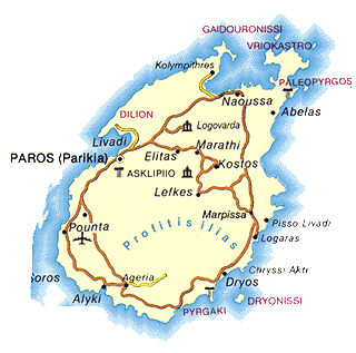
I was woken up at 5:30 in the morning by the mosquitoes and could not get back to sleep. Instead, I made a coffee and read in the cockpit until Alice woke up. We then prepared for our departure. By 0915 we had raised our anchor and were on our way to Naoussa (Νάουσσα) in the island of Paros. There was a light wind from the NW and while we could sail slowly we motor-sailed instead since I wanted to run the watermaker and replenish our fresh water supply. After reaching Cape Velastasi the wind veered from the NNW averaging about 18 knots with gusts up to 25. I turned off the engine and reefed the main to the 1st reef and we sailed with a reduced genoa. For a while we had a nice fast sail but then again the fickle wind died to 4 knots forcing us to motor-sail until it picked up again. This continued until we reached Naoussa.
We arrived in the Naoussa Bay [37° 08.6' N 25° 14' E] at 1400 having sailed 27.4 M. We anchored at the bay of Ayios Ioannis at 8 m.
The island of Paros (Πάρος) has been famous since antiquity for its excellent translucent marble, called Lychnites. This marble was used for the Temple of Solomon, the Venus de Milo, the temples on Delos, and for Napoleon’s tomb. It is an oval shaped island with an area of 195 km² and 10,000 inhabitants. It has two peaks: Profitis Ilias 771 m (2530 ft) and Karamboli 747 m (2451 ft). Its main town and port, Paroikia, is on the W side of the island. Paros was first inhabited by Cretans and then by Arcadians under their leader Paros, after whom the island was named. During the Persian Wars, Paros sided with the Persians. When Athens emerged victorious from those wars, they dispatched Miltiades, the victorious general from the battle of Marathon, to punish the Parians. They resisted successfully. During the Peloponnesian War, Paros was forced by the Athenians to join them in the Delian League. In the 3rd century BC, the island was conquered by the Macedonians who were followed by the Romans. The famous Hellenistic sculptor, Skopas was from Paros. In 1207 AD Paros became part of the Dukedom of Naxos, established by the Venetian Marco Sanudo. In 1389 the then-Duke of Naxos gave Paros to his daughter as part of her dowry. In 1536 the island was captured by Barbarossa and eventually became part of the Ottoman empire, but was mostly under the control of pirates. In 1670 it became the base of operations of the famous pirate Hugues Chevaliers who inspired Byron’s Corsair. In 1770 the Russian fleet spent the winter in Paros. During the 1821 war of Greek Independence, Manto Mavrogenous, whose parents were from Paros and Mykonos, led all of her ships against the Ottomans. Paros became part of the Modern Greek state in 1830. Today the island is invaded every summer by tens of thousands of tourists, yet it still manages to remain one of the most pleasant Cycladic islands.
|
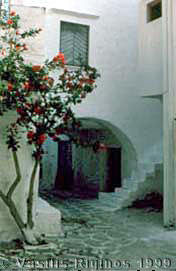
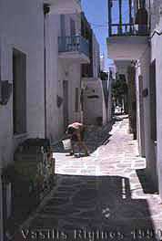
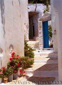
A Street in Paroikia |
I had a nice swim while checking the anchor. While having lunch I noticed that the magnetic compass was leaking and a foul smelling oily fluid was oozing out. I spoke with my brother Nikos on the GSM soliciting any ideas. He suggested that I fill it with alcohol. It was a very messy job, disassembling it, filling it, and sealing it with silicon. I left it upside down to dry overnight. We shall see…
We picked up and tidied our clothes inside the cabins and the mooring lines in the sail lockers. I replaced the main sail sheet lines with new ones and retired the old ones as spares. I asked my younger brother Byron via a SMS (a feature of most GSM telephones that allows the exchange of text messages up to 160 characters) if he can find me a new rod for the floor of zodiac.
Alice made a rice pilaf with wonderful capers that we had purchased in Syros.
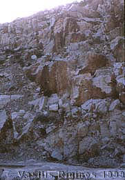
Ancient Quarry |
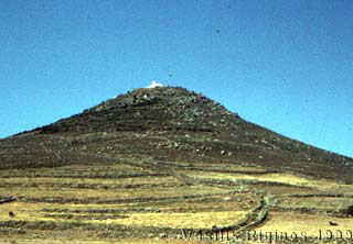
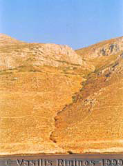
A hill |
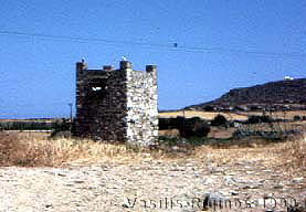
A pigeon-house |

A beach |
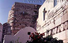
Street in Naoussa |
A Kafenio in Naoussa |

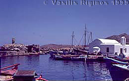
The Inner Harbor of Naoussa |
The Harbor of Naoussa |
Please note that the photographs of Paros shown here were taken on a previous vist in 1983.
Wednesday June 16, 1999 Day 6
In the hope that we can sail, I started the engine half an hour before departing to charge the batteries (we had consumed over 80 Ah) and ran the watermaker because we used a lot of water yesterday washing clothes and showering.
We left Naoussa at 0855 heading S for either Iraklia or Schinousa. The wind was very light and we motor-sailed for a few miles but it was hopeless. At last we lowered the main and put up the tent, at least we were comfortable under the shade.
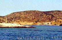
After we reached the narrow channel between Iraklia and Schinousa, Alice chose Schinousa. We entered the narrow anchorage of Myrsini [36° 52.3' N 25° 30.6' E] and anchored at 1310 without any difficulty. The distance we covered was 25.9 M. There was almost zero wind and the chain was hanging.
Schinousa (Σχοινούσα) is a small island of about 85 inhabitants. Its harbor, Myrsini (Μυρσίνη), is very well protected, almost land-locked, but most of the people live in the village of Chora or Panayia.
I tried to re-install the compass but it was still leaking. I applied silicon sealant all over and let it dry some more. Still hoping to repair it. I adjusted the voltage regulator to accommodate the new deep discharge batteries with their heavier plate, to 14.4 V acceptance and 13.9 V float.
In the late afternoon we went ashore and took a long walk up to the village where we got some fresh bread. Later we had an ouzo at Nicholas’ and went aboard for dinner: tagliatelle with fresh tomatoes and mushrooms.
Thursday June 17, 1999 Day 7
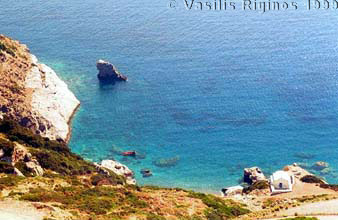
We left Schinousa at 0830 and we headed towards Karos or Keros. We motored as there was no wind whatsoever. We did not stay but just looked because Alice had hoped to see the prehistoric (Cycladic) burial ground. Most of the findings form the burial ground are now at the National Museum in Athens. We decided to try to visit Anti Karos (on a previous trip in 1987 we could not approach this small island due to the strong winds and rough seas). We headed that way arriving at 1055, 4.2 M from Karos. Anti-Karos [36° 50.6' N 25° 40.3' E] where we arrived at 1005, 9 M, it is very arid and rough, there are no paths nor a place where a boat can anchor and safely stay overnight.
We anchored and swam ashore to the sand bar. Lots of seagulls and plenty of tar polluting this otherwise pristine spot. By the time we raised our anchor it was 1145. The wind had picked up 10-15 knots from the NNE but still not strong enough for a good sail. We motored the 9.9 M to Katapola (Κατάπολα), the main harbor of Amorgos. We arrived at 1340, but instead of going in the harbor we anchored at 14 m in a cove just E of Katapola [36° 50.1' N 25° 51.2' E].
It was a pleasant and quiet anchorage, save for a distant dog barking and plenty of mosquitoes. In the evening we took the zodiac to Katapola where we had a walk and an ouzo. Back on Thetis, Alice made a cous-cous with spiced chick-peas.
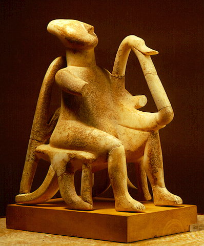
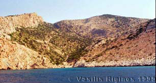
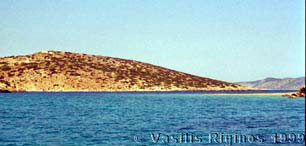
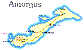
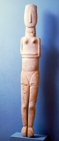
Amorgos (Αμοργός) is the easternmost island of the Cyclades. It has an area of 121 km² and about 1,800 inhabitants. Its tallest peaks are Mt. Krikelos at 826 m (2710 ft) at the NE end, Profitis Ilias at 698 m (2290 ft) in the middle of the island, and Mt. Korakas at 607 m (1991 ft) at the SW end. Amorgos has been inhabited from as far back as 3300 BC. Artifacts excavated last century indicate that it traded with Milos and Egypt. Many Cycladic figurines have been unearthed from Amorgos, including the largest ever found, now in the National Museum in Athens. In the early historical period the island was colonized by the Samians, Milesians, and probably by the Naxians who settled in Minoa, Aigiali, and Kastri (modern Arkesini) respectively. They formed a commonwealth, mined their own coins, and worshipped Dionysus and Athena. During this time a fine transparent linen was produced in Amorgos which became famous to the ancient world as amorgina. After Alexander the Great, Amorgos fell under the rule of the Ptolemies and became a center for the worship of the Alexandrian gods Serapis and Isis. After the Romans occupied the island, they used it as a place for exile, a tradition which was renewed by the Junta that ruled Greece from 1967 to 1971. During the Byzantine era, it was often invaded by Goths, Vandals, and Slavs. In the Frankish period, it first became the fief of Andrea and Jeremiah Gizzi (1207) and later the fief of the Duke of Naxos Marco Sanudo. Then the Byzantines recaptured it and held it until 1269, to be followed by the Gizzis until 1309, the Sanudos until 1352, the Gizzis again in 1352, the Venetians in 1363, and finally by the Querinis of Astypalea in 1446. In 1537 it was captured by Barbarossa and eventually became part of the Ottoman Empire, which held it until the Greek War of Independence in 1821, except for a brief period of occupation by the Russians between 1770-1774. During the Ottoman period, Amorgos was a base for pirates. In the 17th century Amorgos started exporting exquisite embroideries and became quite wealthy from this trade. The island was off the beaten track for tourists until the filming there of Luc Besson’s movie The Big Blue made it well known.
Friday June 18, 1999 Day 8
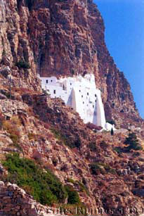
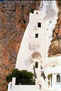
At 0730 we raised the anchor and motored the 0.6 M to Katapola [36° 49.7' N 25° 51.8' E] where we docked stern-to without any problems. We rented a motor-scooter and drove to the famous monastery of Hozoviotisa (Χοζοβιώτησα).
It was very, very hot but the scenery was dramatic with morning vapor clouds rising from the flat sea half way up the sheer cliffs of the S side of the island. After we parked, it took 20 sweaty minutes to climb to the monastery. It is still the same as I remembered it from the last time Thetis was in Amorgos, back in 1987.
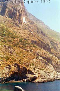
The Monastery of Hozoviotisa which is on the south cliffs of Profitis Ilias was founded by the Byzantine emperor Alexios Komnenos in 1088 AD. Legend has it that during the war of the iconoclasts an icon of the Madonna, reputed to be painted by St. Luke, miraculously floated from Constantinople to the cliffs of Amorgos after being cast into the sea by a pious lady who wanted to prevent its destruction. Now, this icon along with 98 precious Byzantine manuscripts, is part of the Monastery’s treasure. The monastery built by Komnenos was at the location of an older monastery built around 800 AD by monks from Hozova in the Middle East, fleeing the iconoclasts.
|
|
We then drove to the village of Arkesini which, according to the tourist guide, is very picturesque. We were disappointed! Then, we drove towards Chora stopping on the way at a prehistoric settlement but there was not very much there to actually see. At Chora, despite the heat, we walked around. It is a pleasant town despite the strong evidence of too many tourists. Thankfully it was too early in the season. We had a refreshing orange juice and then drove down back to Katapola.
In Katapola, we returned the scooter and bought a case of drinking water. Although Thetis has a watermaker, we prefer to drink bottled spring water rather then the water from the tanks. We also bought some hand woven baskets, as these are getting harder to find in Samos. On the dock we met an old salt with an ancient American flagged sailing boat named Salt Daug.
We departed Katapola at 1430. No wind. We put up the tent and motored for 7.2 M East to Nikouria (Νικουριά) island, just opposite of Kalotiri [36° 52.9' N 25° 55.2' E], where we arrived at 1550. We anchored in the pleasant little bay and had a swim. The water was very clean. The island was once a leper colony but now there is hardly any evidence left from those days except for the foundations of some buildings. We took this opportunity to wash down the boat.
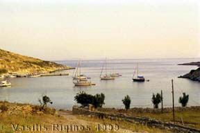
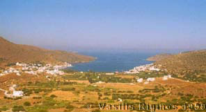
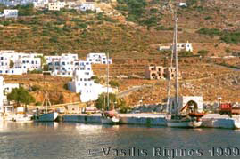
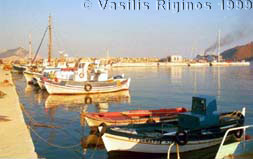
We raised the anchor at 1705 and motored around Nikouria. We arrived at Aegiali [36° 54.2' N, 25° 58.5' E] (Αιγιάλη) at 1820, 6.7 M. Although there was plenty of room to dock side-to, we chose to anchor offshore. We did so without any problem. Heikell does not mention that it is possible to anchor off here. He also mentions that the holding is bad and made difficult by the rocks. We actually found weed and mud and good holding.
We went ashore and walked around the pleasant little town. We had an excellent dinner of fresh fish at the Korali restaurant which is owned by Nikos’ friend Dimitris Vekris. They have their own fishing caïque Katerina which supplies them with the fish.
The Harbor |
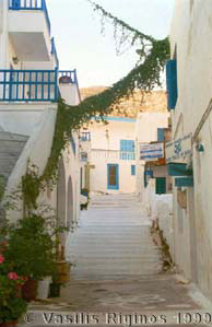
A Street |
Saturday June 19, 1999 Day 9
We had a good night sleep, no mosquitoes, no noise. Early in the morning I went ashore with the zodiac to get some bread but the baker said that the bread will not be ready till 8:30, it was 7:00! Greece has really changed, bread used to be available by 4:00 am!
Back aboard Thetis we raised the anchor and left Aegiali at 0735 for Patmos. Still no wind. We motored. The only consolation was that we were at least charging the batteries. It seems that these new batteries charge more slowly than the old ones. We also ran the watermaker and replenished our water supply. The compass was still leaking, so I put more silicon sealant all around its inner ring. I let the upper half dry, rotated the compass and sealed the other half. We were making very good time at better than 6.5 knots.
We decided not to go to busy Skala but to find an attractive anchorage somewhat to its S and go to Skala tomorrow for refueling. We arrived at the pleasant anchorage of Petras (Πέτρας) [37° 17.7' N 26° 33.7' E] at 1355, having traveled 39.7 M. The holding, again, was not as bad as Heikell would have you believe, but the bottom was soft mud. We anchored at 6 m. It is a nice, quiet place, just a few nudists basking in the sun at the beach. There were four other sailboats anchored at some distance from us.
After thoroughly cleaning the zodiac, we went ashore for a long walk. Later we cooked our dinner and ate it in the cockpit.
Sunday June 20, 1999 Day 10
In the morning we prepared to go to the main harbor of Patmos, Skala, in order to get fuel. This is one of the few places in the Eastern Greek Aegean where one can refuel directly from a pump. Before leaving, I put more sealant at the other half of the compass but I am afraid it will not work. We left the anchorage at 0800 and we motored the 3.2 M to Skala [37° 19.4' N 26° 32.9' E] where we went directly to the fuel dock and docked side-to without any problems at 0830. With two people and no wind, this maneuver is very easy. We topped the tank and filled the two extra 20 L jerry cans which were lashed on the life lines. These I had borrowed from Nikos so that I will have more spare fuel during the trip to the Black Sea. All together we took 85 L.
After refueling, we moved the boat from the dock, anchored offshore, and went ashore with the zodiac for provision shopping. Skala has very good stores at a relative short distance from each other.
By 1055 we were back aboard Thetis and after raising the anchor we departed for the nearby island of Arki (Αρκοί). The wind had picked up a little to 8-18 knots NE. We arrived in Porto Sretto [37° 22.4' 26° 44.3' E] at 1255 having motor sailed 10.3 M. We anchored after 2 attempts at 7 m. This is the first location since leaving Glyfada that the GSM phone had no signal.
I started preparing the boat for our arrival tomorrow in Samos where Thetis will be left for three weeks before departing for the Black Sea. I installed a missing snap for the canvas instrument cover, and I filled the watermaker with biocide solution, etc. The compass, I decided, was beyond redemption. I will order a new one and ask Cynthia to bring it to Samos. In the mean time, Alice packed our bags. The plan being to leave early in the morning for Pythagorio and leave the boat without any extra delays.
We had a nice supper of pasta with a spicy puttanesca sauce.
Monday June 21, 1999 Day 11
The alarm woke us up at 5:00. After the necessary coffee, we raised the anchor and were under way by 0540. There was a breeze of 8-14 knots from the N and we were able to sail for a while with both sails, but then it veered to the NE and dropped to under 8 knots. We had no choice but to start the motor. The sea was very calm. By the time we reached the little island Samiopoula the sails were flapping and we lowered them.
We arrived in Pythagorio (Πυθαγόρειο) [37° 41.2' N 26° 57' E], Samos (Σάμος) at 0945, 23.2 M. The wind was almost gone. Fortunately there was a good space available in the usually crowded harbor and we were able to dock without any difficulties. Alice has by now become as good as our daughters in anchoring.
At the harbor we met our old friends Yiannis and Hugo, the Seafarer agent, who promised to look after Thetis while we will be at Kalami and call me if anything is amiss. I got a warm reception at the Limenarchio (coast guard) station. They well remembered me from last year.
Thus ends the first leg of this summers adventure.
We had traveled from Glyfada a total of 271 M, or 44.72 travel hours.